Archive

Cruising

Next morning Inyanga castoff from our raft after goodbyes and motored out of the harbor. They had a little farther to go than we did and wanted to get an earlier start. We finished breakfast and tidied up the boat, then raised the anchor for the last time, and picked our way out of the anchorage. Once in the bay, we pointed the bow south and forged on toward Deale.

We had light breezes on the nose, of course. Prevailing winds this time of year are southerlies here in the bay, and all along the Atlantic coast, but it helped being in protected waters, as the chop was minimal and the motion of the boat easy.

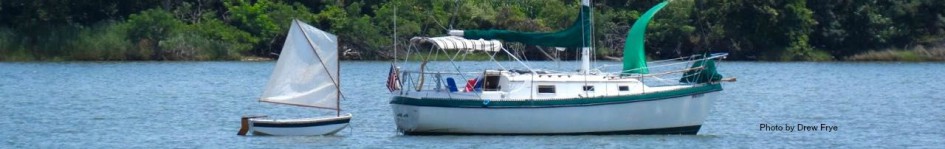
We’re about five miles north of the bay bridge at Annapolis

As we drew closer to the bridge, it grew in height and breadth. Ruth took a several photos of as we approached and passed through.

South of the bridge, we were really in the home stretch. Just 12 miles to go, and everyone of them familiar. The markers for Rockhold Creek hove into sight, and we aimed for the channel.

Travelling up the creek to our home slip, as we have done so many times seemed unreal after our odyssey of approximately 1000 miles, 10 weeks of travel afloat, and countless anchorages.

It’s good to be home! We will savour the conveniences of living on land now that we have spent the summer without them, and we will enjoy the comfort of routine – so starkly different to living life aboard a sailboat.

I don’t think we will undertake so long a trip on the boat again. There are places to go, and things we would love to do on the water, but I think a chartered boat for a week would satisfy those desires. Places like the Caribbean that we would like to sail may be best done through a charter company. We will still have adventures around the Chesapeake, and there are many places here we haven’t explored, but we’ve experienced living aboard for an extended period now, and I think that has satisfied our desire.

We love the cruising condition of the boat now. She’s more capable than ever, and perfectly equipped to enjoy cruising for weeks at a time, or just day-sailing.

Home waters! We motored the one remaining mile of the C & D Canal to the Elk River, that runs directly into the northern Chesapeake Bay. From there all the waters were familiar. We began the day with a fair current which turned against us by about 1300 and dropped our speed to 5 knots, and the light breeze turned onto our nose. Still we forged on until 1530 when the entrance to Rock Hall hove into sight. We made the necessary maneuvers to get into the channel and floated into the calm pool of the northern harbor. We were there about an hour ahead of Inyanga because they sailed with the breezes far to the east, nearly to Baltimore, then cut back across the bay to Rock Hall while we motored most of the way into the wind. We got a good anchor set and called Inyanga to invite them to raft up with us. Ruth cooked a meal of pasta, Brian brought appetizers, and Ruth brought out the brownies she had somehow baked on board in a dutch oven.

We sat for a long time remembering our summer afloat cruising north, then south again. Finally it was time to turn in, which meant me work was really just starting. . . I got the dishes washed, heated water for the shower, and got everything shipshape again, and we turned in for the final evening of the cruise. Tomorrow we would be in our own slip.

Our anchorage is marked by the pin

Our plan had been to go east about the Delaware/Maryland/Virginia peninsula on the return trip and make port calls in the Atlantic coastal cities. We were unable to follow through due to a illness in Brian’s family, so we took the shortest route home through Delaware Bay and the C & D Canal.

We left Cohansey River at 0600 to take advantage of the north bound current through Delaware Bay. It was surreal to motor out through glassy water that the night before had been a raging white capped nightmare. We motored northwest up the bay until we arrived at the canal entrance.

Delaware Bay is a major shipping lane with the ports of Wilmington and Philadelphia up stream on the Delaware River. As we passed a power station a big dredge operation was working on our right. He radioed us and warned us to stay clear, only he didn’t identify himself. At the same time, and large tanker was coming down stream towards us, and called warning us to get out of the way . . . without identifying himself. At the time, I had no idea who was who, and they weren’t interested in explaining themselves. We finally figured it out, but their radio hails were more confusing than helpful.

We entered the Canal west-bound, and made it within a mile of the western terminus before we turned into the port of Chesapeake City.

Saturday night in Chesapeake City is pretty exciting. Well . . . it’s loud, anyway. Power boaters – especially owners of the big, loud, powerful speed boats were in abundance. I guess there were 20 of them rafted up at the restaurant dock bar. Maybe it was a club function. Regardless, on our way to town that in our eight-foot rowing dinghy I was tempted to call out and threaten them with swamping with my massive dinghy wake (I restrained myself. . . ). The band played outdoors; people cheer and yelled, the boaters ran their stereos loudly even though there was a band that was louder than everything. Alcohol fuels most of activity, and I’m not talking about E-90.

We four had dinner that night at the Tap Room, which was crowded and noisy – for good reason. The food was excellent, the staff was friendly and light hearted, and the prices were too low to be true. If ever in Chesapeake City, I would recommend it over any of the waterside bars and restaurants.

We returned to Cay of Sea made our evening routine of showers, medications (we’re old!), teeth, and got into bed.

From our first stop in Chesapeake City.

My last post was titled Two More Days but I only talked about one. Here’s the Second Day, in which lots of calm time riding the boat was in contrast to the drama and panic of anchoring.

We left Cape May via the Cape May Canal, and exited into Delaware Bay northbound. Our planned stop was two thirds the way up at a place called Cohansey Cove, which is adjacent to the Cohansey river. We arrived in good time, covering 38 nautical miles by mid afternoon. We tried rafting, but the chop made that impractical, so we anchored separately. I dozed off while reading, until my place of repose started to act like a bucking bronco. The wind had picked up, as expected, and turned the anchorage into a place of rolling chop, pitching the ends of the boat four feet up, then down four feet every 3 seconds. I didn’t see how we could tolerate this for very long, but the wind was forecast to die down later. We were willing to tough it out for while.

Until Inyanga’s anchor dragged.

The only option was to go into the river, about which we had little data. However, there was a marina up the river with sailboats moored (we could see the tops of their masts) so it must be deep enough for us.

Up we went. Depth did turn out to be problem but not like we expected. 25 feet of depth for anchoring is pretty deep for us Chesapeake sailors. We’re accustomed to 8-15 feet at most. 25 feet of depth took almost all of Brian’s chain to give us a 5 to 1 scope. Still hoping to raft together, we got set up to contribute to dinner together, and then Andy noticed that we moving. The tide had changed and the current reversed. The anchor couldn’t manage the change. We tried to anchor again nearby, but were not confident with the holding. Finally, we decided to go further up the river to find more suitable holding. I found a spot with 12 feet, Brian found some nearby with 15. We anchored separately and gave up on dinner. This time the anchors held well and we stayed put through the night.

Ruth and I had a cold dinner and went to bed early.

Sunset on the Cohansey River

After NYC and overnighting at Sandy Hook, we set off again the next morning for Barnegat Light Inlet. This was another 50 mile trek, but the water was calm and the weather good.

We spent the next day at anchor in Barnegat Light, same anchorage as our outbound trip, and waited out another windy day. No way were we going to venture out into the Atlantic with winds gusting to 25, even if they were blowing from the right direction.

Next day – today – was much better. Winds 10 knots from the northeast (we’re going south now). But the sea state was pretty uncomfortable. In fact, our first attempt to get through the inlet at 0630 was aborted on advice from the Coast Guard. A USCG vessel was passing us in-bound as we were heading out, and they advised us to wait a couple hours for the current change to mitigate the rough conditions on the bar. We were wise to heed their counsel. Two hours later, the conditions were still very challenging but not dangerous. This was a very unpleasant ride, but got better as we made it through the cut and turned south in the open ocean.

I said the conditions improved, but there wasn’t much exhilarating sailing. None, in fact. The wind wasn’t strong enough to keep a sail full and pulling, and the conditions were too difficult to leave the security of the cockpit for setting sail anyway. We motored for 6 hours to Atlantic City (a necessary stop – we just couldn’t make the whole distance to Cape May) and were so glad to get off the water in the afternoon. Although the wind was moderate, the chop and swell was terrible – left over effects of the windy day before.

We left Beverly/Salem on a beautiful Sunday morning anticipating a reasonably short day underway. That did not materialize. What did materialize was an exhaust manifold problem with our buddy boat. They discovered the problem as soon as it happened, so no extra damage was done, but they were dead in the water. We stood by waiting for the towing company to take them under tow into Scituate Harbor. We secured moorings in Scituate, and next day Brian arranged to have the repairs done. But an emergency repair involves ordering parts, wrangling the repair schedule of the shop, then actually doing the repair (which only took about a half hour start to finish). After arriving on Sunday afternoon, the repairs were complete by Thursday. That’s actually not too bad, honestly. And Brian was very confident in the tech’s ability and experience.

Inyanga under tow

So we hung out in Scituate and enjoyed the town. All shops and stores were very convenient to the waterfront, and we could walk everywhere.

A view of Scituate Harbor

Scituate Harbor buzzes with boats. It’s one of the busy boating centers of the Boston area, attractive I would guess, because it’s out of the city and away from big city pricing as well. Sail and power boats seem to be equally represented amongst the fleet. There is also a small, but very active professional fishing fleet whose catch is mostly lobster, but there are several big net operations as well. The boats begin leaving the harbor before first light, powering past our mooring with their super bright light banks that are mounted on steel tubing superstructures above the pilot house, leaving the aroma of sea creatures in their wake. Oh, that’s a strong oder! We see them return in the afternoon, mooring at the city pier in turn, and unloading their catch. Then If we’re up early enough, we can see them loading bait (salted herring) from a truck onto their boats. The pier is very high with the tidal range in excess of 10 feet, so there are 3 hydraulically operated derricks they use for loading and unloading.

We visited the hardware store several times, as well as the grocery store. Amazingly, the ice cream vender only got visited once, but Ruth and I found a breakfast place we liked and ate there twice!

We had a pump partially fail, but I was able to rig a work-around. It’s our fresh water pump that brings water to the galley sink. It still pumps, but it leaks. We found out that a leak was in the system when Ruth tried to get water at the sink, but nothing came out. The bow tank ran empty way too early! We knew we hadn’t used that much water. I saw the leak after putting my head in the bilge and eye-balling it. Fortunately I had an inline valve that was just the right size. I installed that upstream from the pump, and now we close the valve when the pump isn’t needed. I’ll replace the pump when we get home. I’ve rebuilt them before, but with poor results. The rebuilt pump always leaks just as bad as before.

The valve. Yes, I know there’s water in the bilge. There’s always water in the bilge. I drained it right after I took this picture.

There were several days of sailing camp while we moored in Scituate. I saw a fleet of Optimists (8 foot prams) but never saw them sailing. We also saw a fleet of boats that looked very much like lightnings. They cruised through the mooring field weaving through the boats, popping up in unexpected quarters every time we looked around. After several days we began to hear raucous shouts: “starboard, starboard!” as they asserted the belief that they had the right of way anytime they neared another boat in the fleet. They were having a great time standing on the bow with super soakers, pursuing each other, acting like pirates, or America’s Cup sailors.

This crew seems a little tame at the moment.

Their antics looked so fun, I had to launch our own sailing dinghy and cruise the mooring field myself.

So much fun sailing a little boat! You can see the city pier in the background, where the fishing boats load and unload.

And we had to make a repair to one of our dinghy oars. The oars are “leathered” – that is, fitted with a rubber sleeve at the point where the oar passes through the oar lock. My leathers sleeves are actually rubber, with a thick rubber collar at the handle end that prevents the oar from sliding too far up the oar lock. The collar had torn finally, after 25 years of use. Traditionally, these collars are made from leather also, or alternatively line. A turkshead knot is tied onto the oar in the correct location, then tacked down with copper tacks or finishing nails.

Ruth did the rope work because she never saw a puzzles or problem she didn’t like.

And there it is.

Yesterday we covered about 25 milies eastward, still on the Long Island side. The weather seemed iffy when we began, and we heard reports of gusts exceeding 20 knots. We decided to make the jump, and it turned out to be the best day of sailing so far. Leaving Port Washington, we were beset by juvenal dinghy sailors having a great time, shepherded by an instructor – rescue boat. The amount of fun they were having was sometimes exceeded by their unpredictable maneuvers, several times tacking directly across our bow. I slowed down a lot and gave the space their youthful enthusiasm required. One youngster looked surprised when he saw that he had cut across our path and called out “sorry!” to which I replied, no worries I was watching you.

Motoring directly windward, it occurred to me that now would be a great time to make sail. Cay of Sea is a completely manual boat, with few modern conveniences with regard to sail handling. No roller furling, no self tailing winches. Any time a sail change is required, I have to go on deck and see to it. By comparison, our companion boat Inyanga (Island Packet 32) has all the conveniences: roller furling head sails and main, all operated from the cockpit. When we decide to make sail together, Brian pulls a couple lines and poof, he’s sailing. I, on the other hand, spend 10 minutes making things happen on deck before we settle into a point of sail.

This time was slightly different, as I anticipated a need for reefed sails before we ever dropped the mooring. It’s much easier to set the reefs up while the boat is still. So I removed the sail cover from the main, and unbagged the head sail, then set reefs in both. Our 117% genoa has one set of reefs in the foot of the sail. It’s an old idea, but the sail is in great condition, and taking area out of the foot of the sail lets it set perfectly, with optimal shape. Not so with roller furling headsails. As soon as the sail is rolled up by any significant amount, the shape of the sail suffers, and the boat sails less efficiently.

If you look through to the front of the boat in this photo, you can see the foot of the reefed genoa.

This was a great sail. We had a beam reach in 12-15 knots gusting to 20. Cay of Sea set her shoulder down and sailed so well! We were regularly exceeding 6 knots sometimes even exceeding the theoretically practical speed limit of our hull when we surfed a swell. Helm balance is tricky. Too far off the wind and the boat slows down. Too hard on the wind, and the boat feels overpowered, rounding up to windward, heeling excessively, and producing lots of weather helm.

Here I am struggling with a bit of weather helm

Surprisingly, we wound up far ahead of Inyanga, and decided to heave to for five or so minutes so she could catch up with us.

As we angled more tightly to the wind, crew comfort began to trump speed and excitement. I dropped the sails and started the motor, making the final four miles into a charming, protected harbor jam-packed with boats on moorings. We were very fortunate to have gotten slips in the yacht club as transients

Up anchor at 0600, and underway towards NYC. The Battery at the southern end of Manhattan is 17 nautical miles from us at Sandy Hook. I carefully researched the tides and currents for this leg. The East River is nearly unnavigable by a sailboat if the skipper doesn’t time the current correctly. Our 0600 departure was designed to allow us to take advantage of the flood tide as we sailed north and east through New York City.

I counted on a +1.25 knot current in the lower bay. I was wrong. In reality, is was -1.25 to -1.5 knots, so the trip to the Narrows took more than an hour longer than I anticipated. I feared that this would put us behind for catching optimal currents through the river (it’s not really a river – it’s actually a straight through which the current sloshes back and forth as the tide changes). My worries were unfounded. Yes, we got to the Battery later, but the +2.5 knot current after the Battery quickly made up for our untimely progress. From there the current actually gained velocity, and we were touching 8.5 knots over ground from time to time.

The current is hard to predict here. This is the Verrazzano Bridge which marks the end of the Lower Bay, and the beginning of New York Commercial Harbor proper. As soon as we crossed under the bridge, we regained 1.5 knots lost to the current in the Lower Bay, but the tide was flooding the entire time in both bodies of water. I don’t understand how we could be fighting a foul current on one side of the bridge, and benefitting from fair current on the other side.

Gaining momentum with each mile, we began to see some of the historic landmarks.

This famous skyline of the Manhattan business district grew ever larger as we drew nearer.

My wife and shipmate Ruth, with NYC as a background.

Lady Liberty saluting us as we motored past.

From the Battery on Manhattan, we had slightly more than an hour of motoring before we coming to the infamous Hell Gate pool, where three tidal bodies intersect. We zoomed past the Brooklyn, Manhattan, and Roosevelt Bridges averaging 7.5 knots. As we passed Roosevelt Island we donned our life jackets, then suddenly we were at Hell Gate. We paused ever so briefly to take a look at the water condition. Finding it not too terrifying, we plunged through, at one point achieving an unmatched maximum speed of 10.5 knots, while averaging 9 knots. This section of the East River is less that half a mile long, but very turbulent and 90-some feet deep at one place. With strong winds blowing opposite the current direction, it can support standing waves of three to four feet high, with swirling eddies, whirlpools, and back waters. Today, we had flat water, a swift current, and a fast ride through with no drama. Thankfully! It is possible to transverse Hell Gate at slack water, which is ideal, perhaps, but not really necessary.

On past the Queensboro Bridge, past Rykers prison island, and finally past Throg’s Neck Bridge, then we were into Long Island Sound.

35 nautical miles north of Sandy Hook, we are now attached to a mooring in Port Washington watching fireworks all around.

After a three-day stay and several needed repairs, we got off the pier by 0845. Brian still had a little business to clear up, then wanted to manuever a little bit before he left the security of marine services and safe haven, so we waited in the channel, slowly dodging the boat traffic until he got under way. All was well aboard Inyanga, and we set off through the many, many fishing boats that dotted the channel. Manasquan is overwhelmingly a fishing town, private and commercial. I don’t think we actually saw another sailboat while we were there!

Threading our way through the fishing fleet, watching the navigation aids, with one eye on depth and the other on the chart (insert photo of me looking cross-eyed) we made our way to open water and immediately benefitted from the much cooler sea breeze. I don’t think the North Atlantic ever gets very warm, and the effect on the ambient temperature is a welcome relief from the heat and still air of the marina.

We made sufficient offing once through the inlet, and turn left once again, this time with Sandy Hook NJ in our sights. After two hours of motoring, it seemed that the breeze filled in enough to sail.

We had also finished our breakfast underway by then, and relaxed after the scramble getting off the pier. We were berthed in an inside slip, through which the current absolutely ripped, slowing only as high and low water reached their peak. We were leaving on the flood, but it was only an hour or so into the cycle, so the current wasn’t at maximum yet. Still, we needed help from the dock crew to assure departure without mishap. They controlled the bow as we slowly backed out of the slip, then gave the bow a good shove to clear the last piling. I moved forward, continuing to swing to starboard until I could steer straight out into the channel. Whew! Nerve wracking.

Setting sail for another down-wind leg, we turned into the wind to raise the main. Having set the main, I set the genoa after bearing back to our original course. Ruth sheeted the clew of the genoa tight while I attached the pole to the clew. I gradually slid the pole, with with clew attached, out the opposite side from the main, then attached the inboard end of the pole to the mast ring. Ruth trimmed the sheet, and we were off to the races again, averaging 5 knots.

Three hours later, we were approaching the channel marks that guide us into the Sandy Hook Bay. We brought down the sails, and motored around the hook, searching the western side of the hook to anchor. Finally, in Horseshoe Cove, we dropped the anchor at 1530.

You can make out the misty skyline of Manhattan. We’re about 10 nautical miles south of it in this photo.

The blue dot is where we are .

Friday night is typically pizza night, and Brian and Staci joined us for dinner, under a brilliant sunset.

Next day was a stay-at-anchor day, and we explored the beach on both sides of the Hook.

Such a typical beach pic! Floppy hats, sunglasses!

On the Atlantic Side

We rested today, after a very rolly first night in this anchorage. Our second night was very peaceful, but it seems that we’re still catching up on rest. Every time I sat down my eyes seemed to close. We had intended to depart today to transit through NYC on the East River, but we were uncomfortable with our understanding of the route, tides and currents. We will be passing through a very turbulent section of the river called Hell Gate, where the current can exceed 5 knots. We really needed to be comfortable with our plan for that trip, which starts tomorrow at 0600. It’s only about 30 nautical miles from our current location, but the tides and currents are optimal for us if we leave at 0600.

And here’s the end of today . . .

The rigger assessed Inyanga’s damaged stay, and returned just before dark yesterday with the new stay built and ready to install. He climbed the rig like a monkey: hands and bare feet straight up the mast, with bosun’s chair following him, hauled up by his wife. He was done in minutes, attaching the stay at the spreaders, then back down on deck to attach the turnbuckle end. That’s done.

The diver returned today to remove the failed mechanical prop, and reinstall the original fixed prop the boat came with. That did not take 15 minutes. Working under water on a boat is hard. Everything moves all the time especially in a busy waterway like this one. The current is ferocious, and the diver is constantly struggling to stay in place to complete his work. Travis, our diver, was outstanding, very skilled, and experienced. He removed the original prop nut, and Brian and I went to find an additional one that same size to use as a locking nut. His shaft had been modified to accept the Maxprop, which meant that the end was trimmed, and with, it the hole for the cotter pin. So the work around was to place the new thin profile nut in the inside, and use the thick profile nut as a locking nut. 3M 5200 was applied to the shaft in lieu of the cotter pin. After a full cure, I’m confident that the prop is secure.

Dive gear ready

Old original prop ready to be installed. I didn’t get a photo of the Maxprop, but nothing looked damaged. Just the loosened set screw that allowed the blades to articulate had backed out. Since Brian didn’t know what the original pitch of the Maxprop was, and didn’t know how to adjust it, it seemed best to put the old prop back on. The original owner of the boat was the installer of the Maxprop.

So tomorrow the adventure continues. We are wiser now, I hope, and will choose anchorages with a deeper under standing of tides and currents.